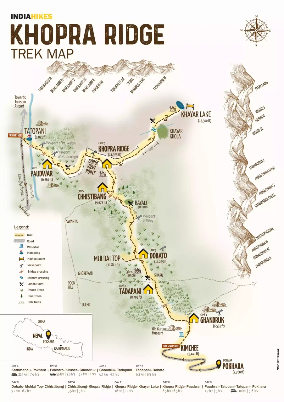
Trek Route Map
Our journey through the Annapurna Conservation Area
Route Overview
The Khopra Ridge trek takes you through diverse landscapes from Pokhara to the stunning Khayar Lake
GPS Track
Our actual GPS route recorded during the trek
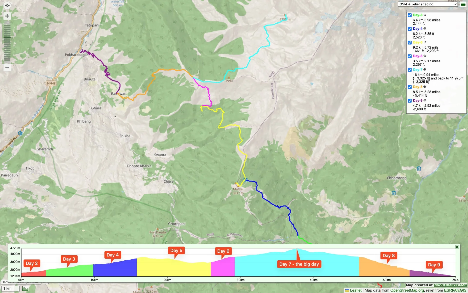
The GPS track shows our complete journey from Ghandruk to Tatopani, capturing every twist and turn of the trail. The route demonstrates the significant elevation changes and the diverse terrain we encountered throughout the trek.
Key Locations on the Trek
Ghandruk
Traditional Gurung village with stunning mountain views
Tadapani
Dense rhododendron forests and panoramic peaks
Dobato
High altitude camp with Himalayan vistas
Khopra Ridge
360° mountain panorama and base for lake trek
Khayar Lake
Sacred high-altitude glacial lake - our summit
Tatopani
Natural hot springs village - perfect for recovery
Interactive Map Coming Soon
Future enhancement will include an interactive Leaflet map with our GPS track, photo markers at actual locations, and clickable points of interest along the route.